Exploring Curacao
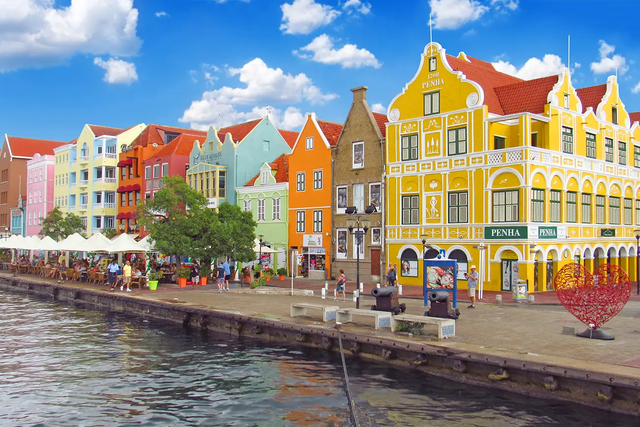
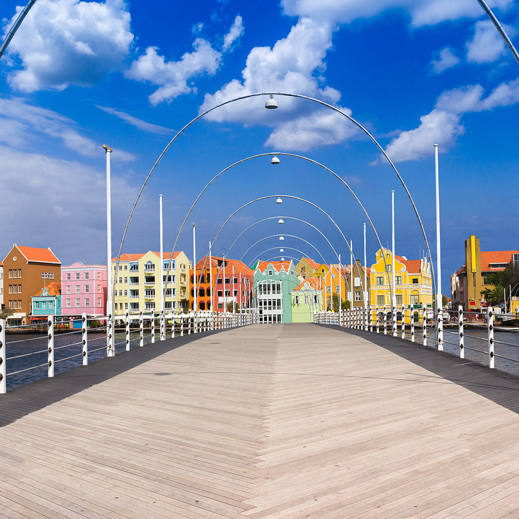
The name "Curacao" means many things to many people. Keen divers will dream of the drop offs and the glimmer of fish scales; history buffs will think about the colorful merchant houses along the waterfront in Willemstad and families will always remember the big smiles and hospitality of the islanders. Nevertheless, there's more to Curacao and to capture its spirit you really need to explore the island from top to bottom, so rent a car or a moped and start planning your excursions.
At 38 miles (61 kilometers) long and between two and seven-and-a-half-miles wide (three to 12 kilometers), it is impossible to get lost on Curacao. The locals refer to the western side of the island as Banda Abao and the east as Banda Riba. To visit the northwest of the island, take the Weg Maar Santa Cruz Road via Soto and to see the east, you should follow Martin Luther King Boulevard from Willemstad. If driving yourself, keep a lookout for herds of goats that stray on to the highway and the occasional pothole.
Maps are available from the Front Desk and you can join staff at the Sunday Orientation Briefing for more information on the day trips and ATV excursions available.
Northward bound
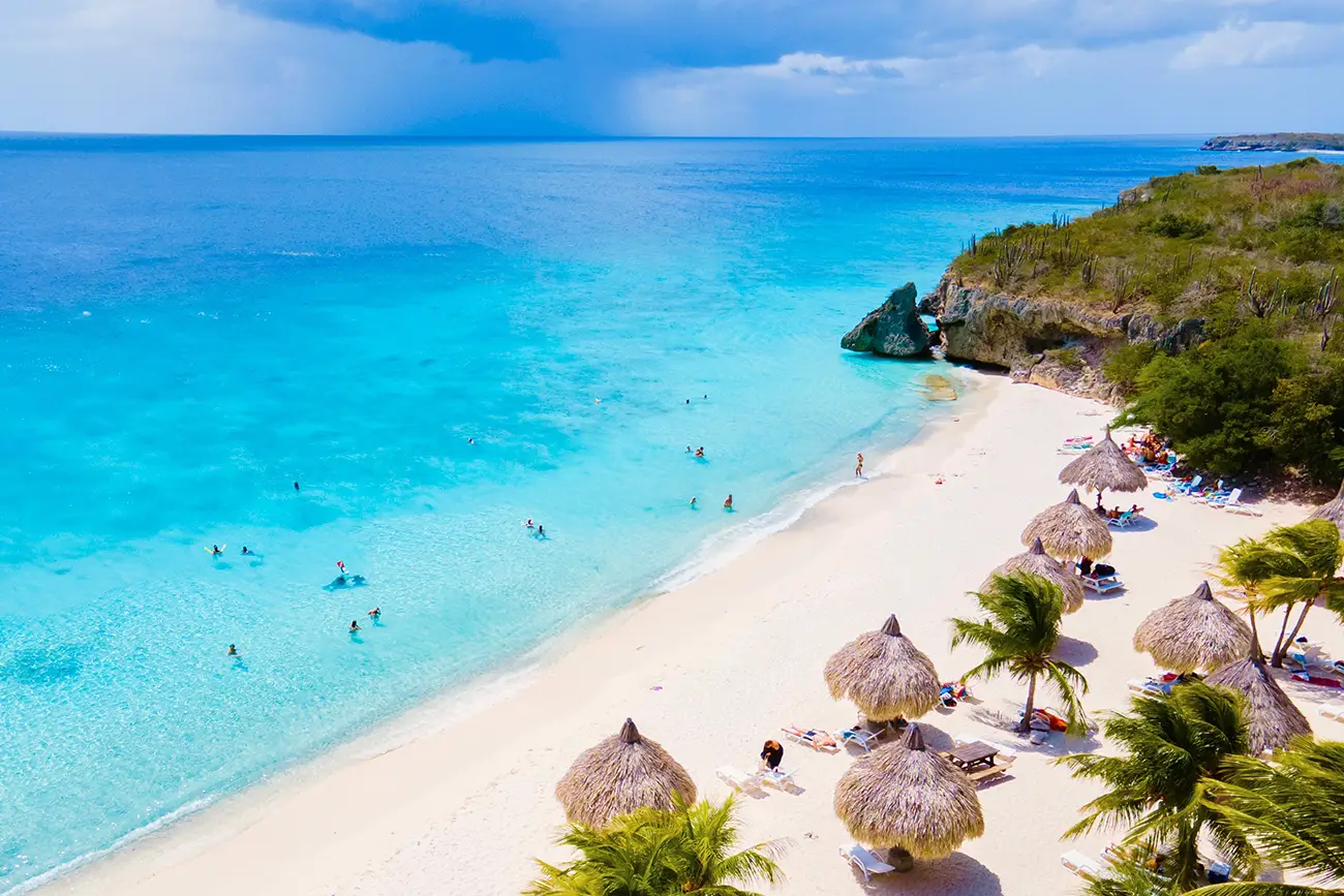
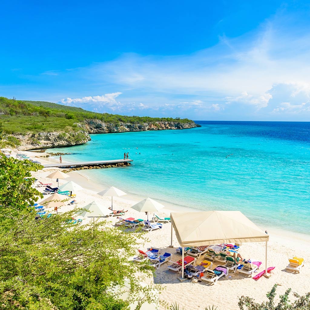
Pick up your sandals, snorkel mask and a picnic and set off in search of your own Curacao beach, the island has 35 different ones to choose from, including tiny bays hemmed with cliffs to crescents of golden sand. Driving north from Willemstad, Blue Bay or Blauwbaai is a family favorite and PortoMari is an idyllic spot for sun worshipping. Also one of the island's best-kept secrets for snorkeling and diving is Porto Marie. Porto Marie has a double reef and there are two snorkeling trails in the bay. Although nothing remains of the Porto Marie landhuis, the estate house or the fort that stood in this spot, there is a network of nature and history trails following the paths once used by the slaves who lived on the plantation.
Further north, you'll find more beautiful beaches at Kas Abou, Playa Lagun and Groot Knip and Klein Knip (Big and Little Knip). Also known as Kenepa, this area played an important role in the island's most important slave revolt in 1795, which began on the Kenepa estate, the largest and wealthiest plantation on the island, now a museum.
Back on the beach trail, Playa Kalki is a pretty bay at the base of the Westpunt or western headland which is protected by one of the island's most beautiful reefs. At nearby Playa Forti, you can watch fishermen at work while local youths leap from the cliffs into choppy waters.
Pounded by the waves, the rugged northern coast of Curacao offers dramatic views. Shete Boka National Park is a chain of bays – the name Shete Boka means seven inlets in Papiamentu –, beaches, limestone cliffs and the piece de resistance, the Boka Tabla headland. A lonely spot for reflection, Boka Tabla has been buffeted by wind and water over millions of years to such an extent that caves, inlets and blowholes have been carved from the rock.
A trip to the Cristoffel National Park in the north of the island gives visitors a glimpse of local flora and fauna, including rare parrots and several species of orchid. There are eight hiking trails through the park and organized wildlife watching activities.
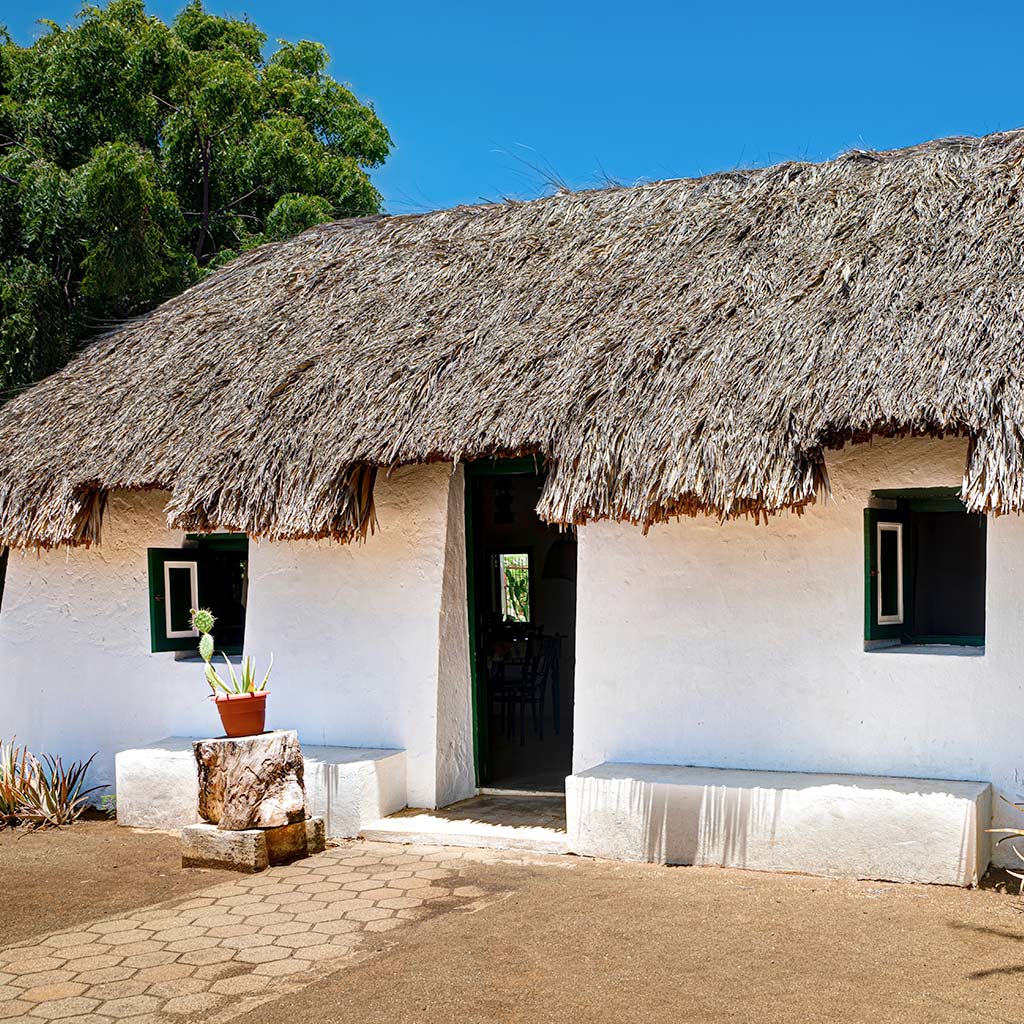
The most challenging hike is a two-hour climb up the slopes of Mt. Cristoffel (1,240 feet). Despite the heat and rocky terrain, the walk is well worth it for the breathtaking views of the Caribbean, with the islands of Bonaire and Aruba in the distance. On a really clear day, you can see the mountains of Venezuela. Located at the entrance to the park, the 18th-century Savonet landhuis is home to the Museum of Natural and Cultural History. Savonet was one of the island's earliest plantations and the exhibits on plantation life and the settlers' efforts to cultivate the arid landscape are very informative.
Central and Southern Curacao
Near the International Airport lies one of Curacao's other attractions, Hato Caves. Formed millions of years ago by the erosion of ancient coral reefs, this labyrinth of subterranean galleries is festooned with stalactites and stalagmites, and when illuminated reveals still pools, a waterfall and the cave paintings of the Arawak Indians who once sought refuge here. Guided tours are available.
Exploring the Kunuku
Islanders refer to the rural areas of Curacao as the kunuku or bush and it is a semi-arid landscape of hills and valleys clothed in drought-resistant shrubs, cactus, acacias and a native tree called the divi divi which is bowed and deformed by the prevailing trade winds.
The kunuku supports a surprising array of flora and fauna. Around 450 plants have been registered; there are eight species of bats on the island, three species of sea turtle nest on the beaches, brightly colored anole lizards sun themselves on the rocks and white-tail deer graze quietly in the bush. Yet birds are the most numerous inhabitants of the kunuku, the island checklist includes flamingos in the Salinja St Marie salt pans, pelicans, parrots, the trupial bird and the cuchubi or Caribbean mockingbird.
Landhuizen
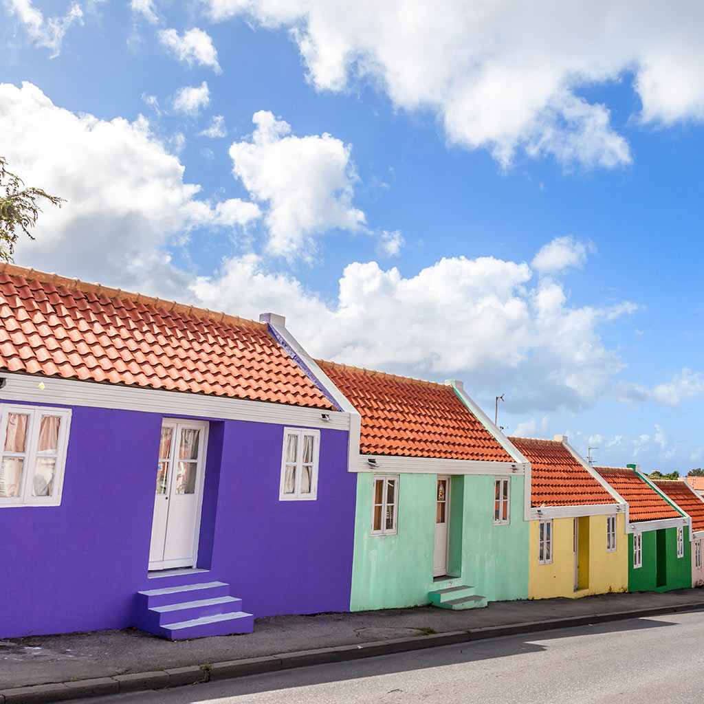
By the late 18th century, over 300 plantations and estates had been founded on Curacao to work the land, growing corn, peanuts and fruit, and exploit naturally occurring salt pans. Many of the brightly painted plantation houses or landhuizen have been restored and give visitors a glimpse of what life was like for the Dutch settlers and the hardships suffered by the African plantation workers. Some are museums, art galleries, cultural centers or restaurants. Visit Kenepa, Brievengat, Jan Kok, Groot Santa Martha, Papaya, Daniel, Dokterstuin and Chobolobo, where you can sample Curacao, the famous liqueur distilled for over 100 years by the Senior family.